
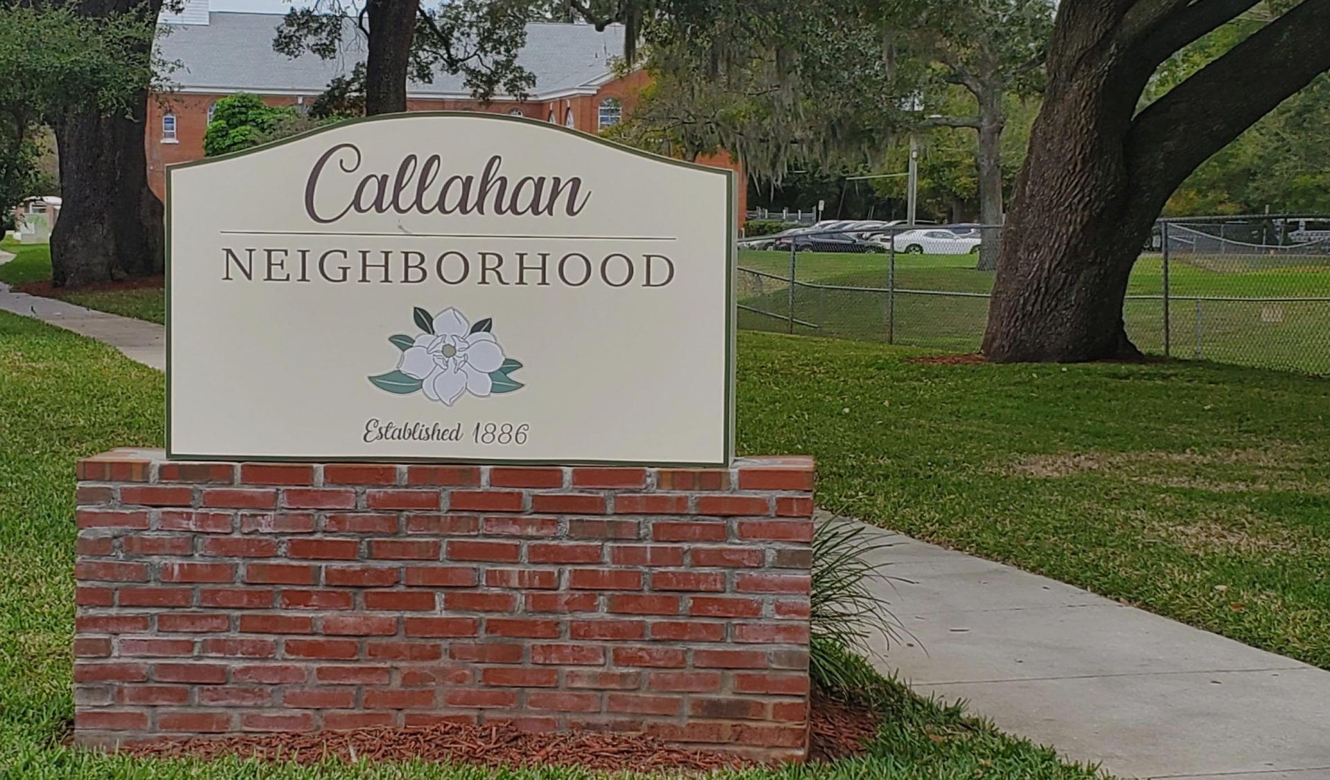
“Where Neighbors know Neighbors”...WE ARE CALLAHAN

history
of callahan in parramore
THE HISTORY of Callahan in Parramore is noteworthy and intertwined. Tracing backward, the original Callahan neighborhood was bounded by Federal street on the north; North Parramore, Chatham and North Division avenues on the east; Grove Park drive and West Washington street on the south; and North Orange Blossom Trail and the Seaboard Railroad on the west. Around 1910, the eastern portion of the neighborhood was composed of white families. By the roaring 1920’s the neighborhood occupancy tilted toward black families. The major industries driving Orlando’s business economy were vegetated agriculture, citrus (oranges, tangerines, and grapefruits) and raising livestock.
White business owners platted separate African-American settlements (housing) near the growing Orlando business district for their black agricultural, domestic, and handy man workers. Hopper Quarters, named after Rev. Andrew Hopper, (Orange County Comptroller’s records list Hooper Quarters), built to house black workers and servants. As the community grew and expand, “Black Bottom” formed; its nickname reflected the interior streets: unpaved, slopped downward and low, with no street drainage system. When it rained, the unpaved dirt streets flooded turning into mud with a distinguishing black color. With churches, a school, and businesses; “Black Bottom” later became Pepperhill. The City officially changed Pepperhill to: “Callahan” in Parramore. From Callahan’s beginnings and growth; cultivated a vibrant, rich, and thriving community: “The alpha of Orlando’s African-American social, educational, religious, and cultural existence.
Learn More
community
our historical home
the neighborhood
In the 32805-zip code west of Downtown Orlando, Parramore is divided into three distinct neighborhoods: Lake Dot (north between Colonial Drive and Amelia Street), Callahan (north between Amelia Street and Central Boulevard), and Holden/Parramore (north between Central Boulevard and Gore Street). All three are bounded on the east by Interstate 4 and on the west by Orange Blossom Trail.
Click to enlarge
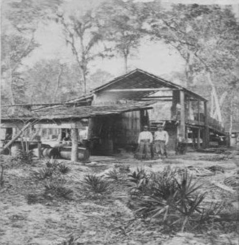
CIRCA 1880. Agriculture, citrus and raising livestock was Orlando’s major trades. Pictured above is a Turpentine distillery. Turpentine was made and distributed throughout Central Florida. Orlando’s local turpentine distillery employed and provided housing for their black seasonal/permanent workers in the Parramore area.
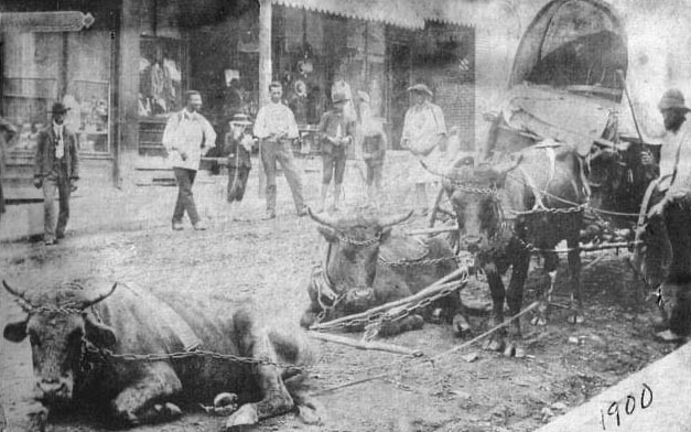
CIRCA 1900. Before Orlando’s railroad regional network was created, the ox-wagon was used to move and deliver agriculture, citrus goods and supplies within Orlando’s business district. The ox-wagon, a four wheeled vehicle pulled by oxen was used. Here the oxs’ are at rest before their next delivery haul. The origin of the Ox-wagon can be traced back to South Africa.
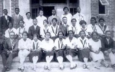
CIRCA 1926. Formerly Johnson Academy, “Orlando’s Black School” the 10th grade class at Jones High School was the first graduating class. Jones High School was located on the corners of Washington Street and Parramore Avenue. Students graduated after completing 10th grade.
Arthur “Pappy” Kennedy
councilmanFirst African American City-Wide Commissioner (1973-1980)
Click to enlarge and read more

Carver Theater

Jones High School

Starks Funeral Home

Usher Board, Mt. Zion